Galen Newman’s research, which is leading to smart planning solutions for cities losing population, has earned recognition from the Council of Educators in Landscape Architecture.
Planning prof's smart planning research recognized by CELA

Galen Newman
[Read July 20, 2016 interview in The Atlantic.] (http://www.theatlantic.com/business/archive/2016/07/rust-belt-survival/492155/?hootPostID=3dcc866403f72e425109b36bba32ef0c)
For a diverse research agenda that includes finding smart solutions for vacated urban spaces, Galen Newman, assistant professor in the Texas A&M [Department of Landscape Architecture and Urban Planning] (http://laup.arch.tamu.edu/) , earned an Excellence in Research and Creative Scholarship Award from the [Council of Educators in Landscape Architecture] (http://thecela.org/) .
Newman accepted the accolade at CELA’s annual May 28, 2017 conference in Beijing.
“Newman is the primary, or co-author, of more than 20 peer-reviewed journal articles in a wide range of multidisciplinary studies that include landscape architecture, urban planning, urban design, and landscape performance,” said Jun-Hyun Kim, LAUP assistant professor, in a nomination letter. “As a junior faculty member, the quantity and quality of his publication record is far beyond his field’s peers.”
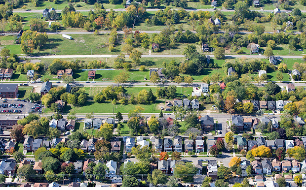
Newman is investigating planning solutions for once-vibrant cities such as Detroit, Buffalo, N.Y., and Youngstown, Ohio that are plagued by growing vacant areas caused by shrinking populations.
To devise a planning strategy for these spaces, Newman explores their unique urban designs and landscape characteristics and predicts future vacancies with geographic information systems-based models.
“These predictions will greatly enhance public, private and financial institutions’ ability to collectively address this problem,” said Jon Rodiek, LAUP professor, in a nomination letter.
Among his additional research-based projects since joining the Texas A&M faculty in 2011, Newman has investigated flooding and pollution in Houston’s Sims Bayou, a major municipal runoff drainage channel, recommended amenities for a proposed Ike Dike intended to protect the Galveston/Houston area from hurricane storm surges, and helped create a scorecard to help city planners assess whether a community’s hazard plans actually target areas most vulnerable to natural hazards such as floods or hurricanes.
Richard Nira
rnira@arch.tamu.edu
Tags
- feature
- honors
- land development
- landscape architecture & urban planning
- laup gallery
- planning
- research
- rss
Related Posts


Planning prof presents hazard mitigation ideas

Planning profs studying systems, hazard plan links


Study eyes how lower Lake Conroe levels impact economy
Follow Us
Facebook Twitter Vimeo Youtube Flickr RSS
Recent Posts


Planning prof heads study of disaster housing aid

A message from the dean


_thumbnail_small.png)

Former student remembered as expert planner


Leading educator named new head of Architecture Dept.
