Planners can determine whether hazard plans address a community’s most vulnerable areas with a scorecard developed in part by planning researchers at Texas A&M.
Planning researchers develop ‘scorecard’ for hazard plans

Galen Newman

Phil Berke
[Listen] (http://planningdesign.podbean.com/e/2015-japa-best-paper-award-professor-phil-berke-talks-about-his-award-winning-paper/?token=ecfa76e22f87bd32668d71117dc6b7da) to Berke discuss developing the scorecard.
Planning researchers at Texas A&M have developed a scorecard to help city planners assess whether a community’s hazard plans actually target areas most vulnerable to natural hazards such as floods or hurricanes.
A paper describing the scorecard’s development and testing earned Best Paper honors from the Journal of the American Planning Association in 2015.
The effectiveness of hazard plans can be reduced because plan development is often isolated from other efforts governing land use and development in hazard areas, and because multiple hazard plans are developed to mitigate various aspects of natural hazards, said Phil Berke, one of the study’s researchers and Texas A&M professor of [urban planning] (http://laup.arch.tamu.edu/) .
In a study, “Evaluation of Networks of Plans and Vulnerability to Hazards and Climate Change: A Resilience Scorecard”, Berke and a team of researchers developed a scorecard that planners can use to create an index that measures how much a community’s plans decrease its physical and social vulnerability to hazards, and how well these plans are integrated, by referencing widely available national and local databases that include socioeconomic status, floodplain areas, housing types and other metrics.
“By using the scorecard, we can identify vulnerability issues and appropriate planning solutions,” said Berke. “With this information, planners and other local officials can determine how a community might adapt its plans to increase its hazard resiliency.”
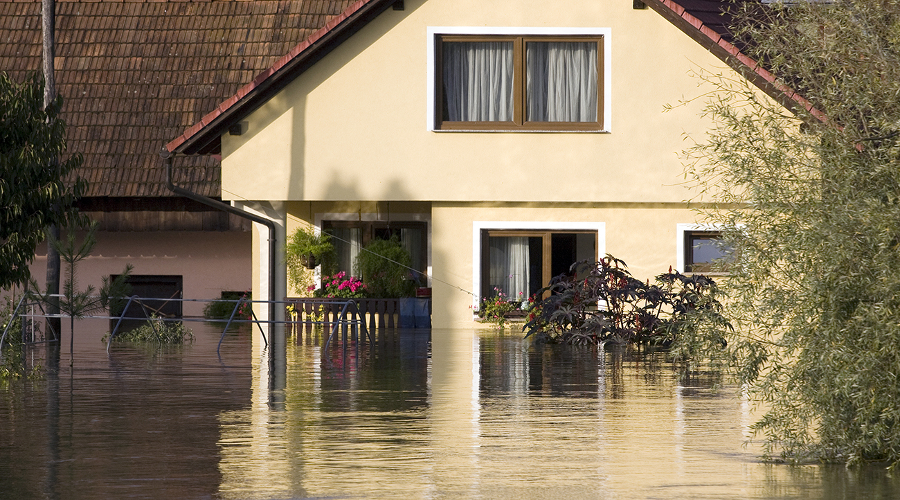
During the study, funded by the Department of Homeland Security, researchers tested the scorecard in Washington, North Carolina, and found that the coastal community’s hazard plans didn’t necessarily address areas most vulnerable to floods or sea level risks and that some plans actually increased physical and social vulnerability to hazards.
The study, conducted with $305,000 from the U.S. Department of Homeland Security through 2017, will continue with additional scorecard testing in Atlantic and Gulf Coast communities.
Researchers have also received National Science Foundation funding to test the scorecard in Rotterdam, Holland.
The study’s Texas A&M contributors include Galen Newman, assistant professor of urban planning, and Jaekyung Lee, a [Ph.D Urban & Regional Sciences] (http://laup.arch.tamu.edu/academics/graduate/ursc/) student.
Additional researchers include Tabitha Combs, senior lecturer in Urban and Regional Planning at Lincoln University in Lincoln, New Zealand; David Salvesen, deputy director of the Center for Sustainable Community Design at the University of North Carolina at Chapel Hill, and Carl Kolosna, a Master of City & Regional Planning student at UNC.
Tags
- graduate work
- hazard reduction & recovery
- hrrc gallery
- institute for sustainable communities
- landscape architecture & urban planning
- laup gallery
- planning
- research
- research gallery
- sustainability
Related Posts

Study: Focused plans help cities prepare for climate change

Museum showcases HRRC-developed housing program

Planning prof helps write paper urging coastal policy change

Eagle quotes profs on state’s vulnerability

Texas A&M hazard team's 'scorecard' adopted by Norfolk
Follow Us
Facebook Twitter Vimeo Youtube Flickr RSS
Recent Posts


Planning prof heads study of disaster housing aid

A message from the dean


_thumbnail_small.png)

Former student remembered as expert planner


Leading educator named new head of Architecture Dept.
